- Home
- Comprehensive GIS Mapping Services for Urban Planning and Environmental Management in Kenya & Tanzania.
Geographical Information Systems (GIS) & Mapping
Overview
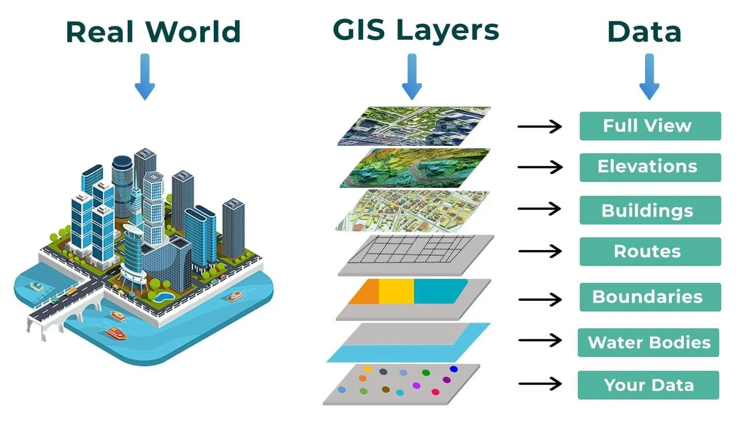
Our Geographical Information Systems (GIS) & Mapping department specializes in spatial data analysis, urban planning, water resource management, and environmental conservation. We leverage cutting-edge technology to deliver accurate and actionable insights, ensuring that our clients have the tools they need to make informed decisions. Whether it’s mapping infrastructure, analyzing environmental data, or supporting sustainable development, we provide tailored GIS solutions to meet your needs.
GIS technology plays a critical role in modern decision-making processes. At Ellipsoid Consultants Group, we use advanced tools like ArcGIS, QGIS, and TerraScan to process digital aerial photographs, LiDAR data, and other spatial datasets. Our expertise spans urban planning, agriculture, environmental conservation, and water resource management. For example, GIS can be used to locate safe water resources, calculate water service coverage, and assess the functionality of water facilities.
In addition, we provide detailed mapping services for web platforms and publications. Our maps are designed using the latest cartographic techniques and printed on high-quality plotters like the HP Z2100. Before any project begins, we conduct topographical surveys to produce contoured maps and cross-sections, ensuring accuracy and precision in every deliverable.
What Clients Can Expect
- Accurate and comprehensive spatial data for informed decision-making.
- Customized GIS solutions tailored to their specific needs and industry requirements.
- Seamless integration of GIS data with existing systems and workflows.
- Expert training programs to empower their teams in utilizing GIS tools effectively.
- Compliance with local and international standards for environmental and land-use planning.
- Detailed topographical surveys and mapping services for infrastructure projects.
- High-quality outputs, including contoured maps, cross-sections, and digital map products.
- Timely delivery of projects with clear communication throughout the process.
- Support from a team of registered professionals with expertise in GIS, engineering, and environmental consultancy.
- Cost-effective solutions that maximize value while maintaining quality and precision.
At Ellipsoid Consultants Group, our GIS & Mapping department is committed to delivering innovative solutions that drive success. From urban planning to environmental conservation, we provide the tools and expertise needed to tackle complex challenges. If you’re ready to harness the power of GIS for your project, contact us today to discuss your requirements and explore how we can help you achieve your goals.
 How can we Help you?